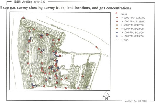
A new fast method for locating leaks in landfill caps uses a multi-channel IR analyzer (in conjunction with a GPS system) to monitor for methane, carbon dioxide, and non-methane hydrocarbons, several times per second A 15 acre landfill cap was surveyed on parallel tracks 5 ft apart in one day.
The figure shows the mapped LFG leaks. About 30 leaks were identified.
Each of these sites was then surveyed in detail to find the exact point of maximum LFG concentration – this was completed in a half day.
The technique has also been used to back-trace surface leaks to the exact source of leakage in the geomembrane on slopes and at culverts and roads; geomembrane leaks can be several meters from the maximum concentration on the cover soil surface. Leaks have also been found to be extremely localized on the cover layer surface – some being apparent over only an inch or two.
Contact: icorp@geosynthetic.com