As Nearly 80 years of erosion data in the United States informs the massive RUSLE2 database, led by the US Department of Agriculture’s Natural Resources Conservation Service. In this episode, Dave Lightle shares his 40+ years of experience with the RUSLE2 mathematical prediction tool for erosion processes and better land management planning, including how the system extended beyond being a tool for farmers and ranchers and now enhances designs in urban runoff, mine remediation, landfill capping, and more.
MORE GEOTALK: Creating Strong Environmental Programs
We thank Tencate Geosynthetics for sponsoring this week’s episode.
RUSLE2 AND HALTING EROSION
“The basic research actually to all types of land use,” says Lightle, noting that the Universal Soil Loss Equation was originally developed for farm and ranch land conservation planning. “There’s about 10,000 plot years of data that was collected in the ‘40s, ‘50s, and early ‘60s on established slopes in research stations, where they had a standard slope length and slope steepness.”
The testing included multiple climates and cover systems, different land contours and exposures. The resulting USLE, now in its RUSLE2 revised format, emerged from all of this.
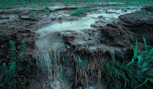
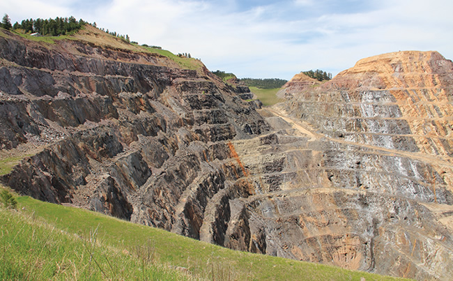
“It’s adaptable very easily to things like mine reclamation work, sanitary landfill caps, anything that has an exposed period of time of bare soil and then you apply various kinds of treatment, either mulch and seed, or maybe you break the slopes up into shorter segments with some sort of benches or diversions—just about any application where you can apply something to reduce erosion or trap sediment we can model with RUSLE2.”
The RUSLE2 database can be utilized in pre- and post-construction analysis. It’s applicable to lineal construction like pipelines, electrical transmission lines, road corridors, etc.
“My role has primary been in training,” Lightle says. “Specifically in customizing the databases so it has plans and practices in the database that represent what engineers plan for a particular site. That way, we can get a pretty accurate estimate of the effects of applying different kinds of treatment on the site.”
The task of customizing is more complicated every day, due to the rapid growth of erosion and sediment control technologies and the ever-stronger science behind them. Lightle, who was interviewed at the International Erosion Control Association Conference and Exhibition, notes that he often takes an extra day or half-day just to walk the IECA show floor and stay current with new approaches in the marketplace. These materials need to be considered for incorporation into RUSLE2 to keep it relevant and effective.
Listen to his thoughts in the GeoTalk Podcast for more detailed insight.
Dave Lightle is an Erosion Model Consultant based in Missouri. He specializes in custom RUSLE2 training, support, and database development for agriculture and the construction industry.
RESOURCE: USDA – ARS Page on RUSLE2


